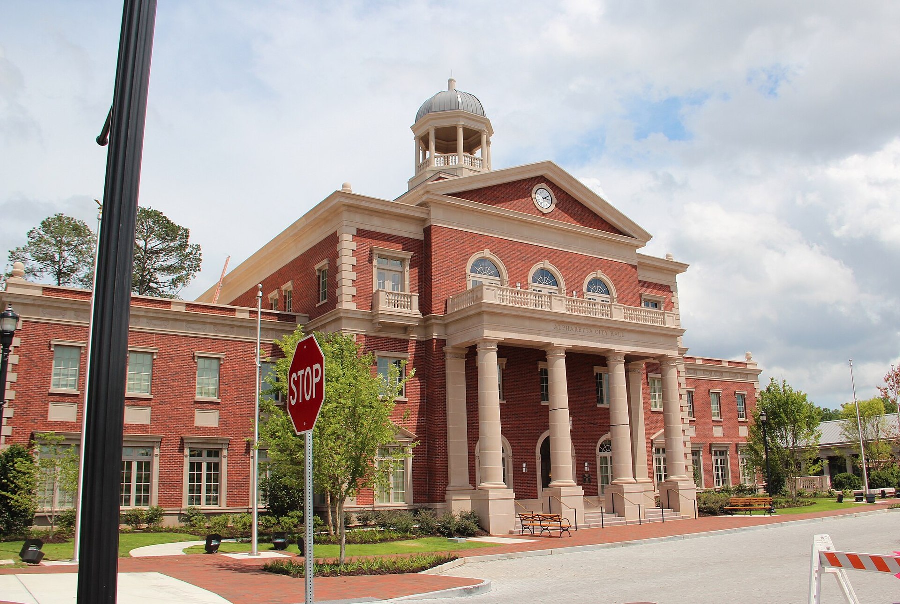
Alpharetta source photograph

Outdoors

Biking and mountain biking near Alpharetta

Trails and recreation areas near Alpharetta open to biking and mountain biking.

16places to ride
5 mito the closest
8within 30 miles
September–Maybest months

Good to know: Wilderness areas are closed to bikes; check each area’s trail rules and yield to hikers and horses.

Closest picks

1

Chattahoochee River National Recreation Area

5 mi south · National Park Service

Today the river valley attracts us for so many reasons. Take a solitary walk to enjoy nature’s display, raft leisurely through the rocky shoals with friends, fish the misty waters as the sun comes up, or have a picnic on a Sunday…

2

Lake Sidney Lanier

13 mi northeast · US Army Corps of Engineers

Nestled in the foothills of the Georgia Blue Ridge Mountains lies Lake Sidney Lanier, one of America?s favorite lakes. Over 7.5 million people a year choose to visit Lanier.

3

Bald Ridge Creek

14 mi northeast · US Army Corps of Engineers

Bald Ridge Creek Campground is on Lake Sidney Lanier, popular for its aqua-blue waters and spectacular scenery.

Map of all 16 places

Map of 16 places loads as you scroll.

Within 30 miles (8)

5 mi south · National Park Service

Chattahoochee River National Recreation Area

Today the river valley attracts us for so many reasons. Take a solitary walk to enjoy nature’s display, raft leisurely through the rocky shoals with friends, fish the misty waters as the sun comes up, or have a picnic on a Sunday…

  • Biking
  • Boating
  • Fishing
  • Paddling
  • Wildlife viewing

13 mi northeast · US Army Corps of Engineers

Lake Sidney Lanier

Nestled in the foothills of the Georgia Blue Ridge Mountains lies Lake Sidney Lanier, one of America?s favorite lakes. Over 7.5 million people a year choose to visit Lanier.

  • Biking
  • Boating
  • Camping
  • Fishing
  • Hiking
  • Horseback riding
  • Hotel/Lodge/Resort Privately Owned
  • Nature education

14 mi northeast · US Army Corps of Engineers · Campground

Bald Ridge Creek

Bald Ridge Creek Campground is on Lake Sidney Lanier, popular for its aqua-blue waters and spectacular scenery.

  • Biking
  • Boating
  • Camping
  • Fishing
  • Kayaking
  • Swimming
  • Water Access

20 mi southwest · National Park Service

Kennesaw Mountain National Battlefield Park

Kennesaw Mountain National Battlefield Park is a 2,965 acre National Battlefield that preserves a Civil War battleground of the Atlanta Campaign. Opposing forces maneuvered and fought here from June 19, 1864 until July 2, 1864.

  • Biking
  • Hiking
  • History
  • Horseback riding
  • Wildlife viewing

21 mi northeast · US Army Corps of Engineers · Campground

Old Federal

Old Federal Campground lies on the eastern banks of Lake Sidney Lanier in Northern Georgia.

  • Biking
  • Boating
  • Camping
  • Fishing
  • Picnicking
  • Swimming
  • Water Access
  • Water Activities

25 mi northeast · US Army Corps of Engineers · Campground

Duckett Mill

Duckett Mill Campground is located on Lake Sidney Lanier. With over 692 miles of shoreline, the lake is well known for its aqua-blue water, spectacular scenery and variety of recreational activities.

  • Biking
  • Boating
  • Camping
  • Fishing
  • Picnicking
  • Swimming
  • Water Access
  • Water Activities

26 mi east · USDA Forest Service

Chattahoochee-Oconee National Forest

  • Biking
  • Boating
  • Camping
  • Fire Lookouts/Cabins Overnight
  • Fishing
  • Hiking
  • Horse Camping
  • Horseback riding

28 mi west · US Army Corps of Engineers

Allatoona Lake

Allatoona Lake is one of the most frequently visited U.S. Army Corps of Engineers lakes in the nation.

  • Biking
  • Boating
  • Camping
  • Fishing
  • Hiking
  • History
  • Hotel/Lodge/Resort Privately Owned
  • Nature education

30 to 75 miles (2)

32 mi south · National Park Service

Arabia Mountain National National Heritage Area

For millions of years, granite monadnocks have stood watch over the rivers and forests of Georgia.

  • Biking
  • Hiking
  • Picnicking
  • Wildlife viewing

45 mi northwest · US Army Corps of Engineers

Carters Lake

Carters Lake Project is managed by the U.S. Army Corps of Engineers, Mobile District. Carters Lake is one of the most scenic lakes in the Southeast.

  • Biking
  • Boating
  • Camping
  • Fishing
  • Hiking
  • Hotel/Lodge/Resort Privately Owned
  • Picnicking
  • Water sports

75 miles and farther (6)

81 mi west · National Park Service

Little River Canyon National Preserve

Little River is unique because it flows for most of its length atop Lookout Mountain in northeast Alabama.

  • Biking
  • Climbing
  • Fishing
  • Hiking
  • Horseback riding
  • Hunting
  • Paddling
  • Picnicking

84 mi northwest · USDA Forest Service

Cherokee National Forest

  • Biking
  • Boating
  • Camping
  • Fire Lookouts/Cabins Overnight
  • Fishing
  • Hiking
  • Horse Camping
  • Horseback riding

84 mi northwest · National Park Service

Chickamauga & Chattanooga National Military Park

In 1863, Union and Confederate forces fought for control of Chattanooga - a gateway to the Confederacy. The Confederates were victorious at nearby Chickamauga in September.

  • Biking
  • Climbing
  • Hiking
  • History
  • Horseback riding
  • Paddling
  • Picnicking

93 mi southeast · National Park Service

Ocmulgee Mounds National Historical Park

to Ocmulgee Mounds National Historical Park. This park is a prehistoric American Indian site, where many different American Indian cultures occupied this land for thousands of years.

  • Biking
  • Fishing
  • Picnicking
  • Wildlife viewing

114 mi north · National Park Service

Great Smoky Mountains National Park

Ridge upon ridge of forest straddles the border between North Carolina and Tennessee in Great Smoky Mountains National Park.

  • Biking
  • Camping
  • Fishing
  • Hiking
  • History
  • Horse Camping
  • Horseback riding
  • Picnicking

122 mi east · US Army Corps of Engineers

J. Strom Thurmond Lake

Thurmond Lake is the largest Corps of Engineers lake east of the Mississippi River. The lake encompasses 1,200 miles of shoreline, 70,000 acres of water and 80,000 acres of land.

  • Biking
  • Boating
  • Camping
  • Fishing
  • Hiking
  • Horseback riding
  • Hotel/Lodge/Resort Privately Owned
  • Nature education

Distances are straight-line miles from downtown Alpharetta. Listings come from Recreation.gov’s federal recreation database; check each official page for hours, fees, fire restrictions and closures before you go.

Get outside around Alpharetta

Around Alpharetta

Little Free Library in Rock Mill Park, Alpharetta GA
Little Free Library in Rock Mill Park, Alpharetta GAJohn Phelan · CC BY 4.0
Alpha Loop bridge, Alpharetta GA
Alpha Loop bridge, Alpharetta GAJohn Phelan · CC BY 4.0
Ameris Bank Amphitheatre, Alpharetta
Ameris Bank AmphitheatreBullDawg2021 · CC BY 4.0

More outdoors near Alpharetta

Questions

Where is the closest place for biking near Alpharetta?

Chattahoochee River National Recreation Area (National Park Service), about 5 miles south of Alpharetta as the crow flies. Next are Lake Sidney Lanier (13 mi) and Bald Ridge Creek (14 mi).

When is the best time for biking near Alpharetta?

Based on Alpharetta’s average highs, September–May. Conditions at higher elevations can be much cooler.

Who manages these places?

Federal agencies including National Park Service, US Army Corps of Engineers, USDA Forest Service. Each listing links to its official page for hours, fees, closures and current conditions.

Alpharetta AI

Your Alpharetta local guide
Hey there!

I'm Alpharetta AI. Ask about neighborhood food, independent shops, local history or planning a visit.

AI recommendations may be inaccurate. Verify hours and prices. Questions are processed by Cloudflare. Privacy